Demonstration project: Permafrost dynamics visualization tools for the community of Selawik
Project Personel
Main Contact: Dr. Dmitry Nicolsky
Scientific Personel: Lei Cai, Dmitry Nicolsky and Vladimir Romanovsky
Collaborators:
Partner Organizations: USGS Climate Science Center
Project Summary
Previously, we developed 30-m resolution "proof-of-concept" permafrost change projections near the community of Selawik. These projections are based on the 30-m resolution ecotype maps, with about ten distinct ecotypes near the community. The climate forcing for all grid cells in the ecotype raster is assumed to be the same, and upscaling of the numerical results for 10 ecotypes to the entire area is obtained through the ecotype raster. Therefore, the computational time to make permafrost degradation projections near the community is rather small and could be accomplished on a portable computer within a few minutes. We are proposing to develop a scenario building software for the community of Selawik. The community planners will be able to change climate scenarios, modify ground properties based on local knowledge and thus identify local infrastructure vulnerable to climate change. We plan to conduct a few outreach meetings with the local government and assist with identification of permafrost thaw-related hazards in the community.

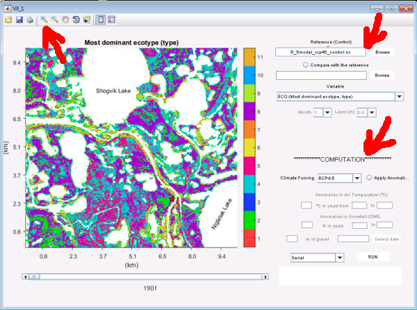
Figure 1. GIPL_GUI startup screen showing vegetation (i.e. ecotypes) around Selawik. Controls (Top arrow) allow for changing the view area, parameters of choice (Right arrow) and computational control for model projections of permafrost temperatures at depth for instance (Lower right arrow).

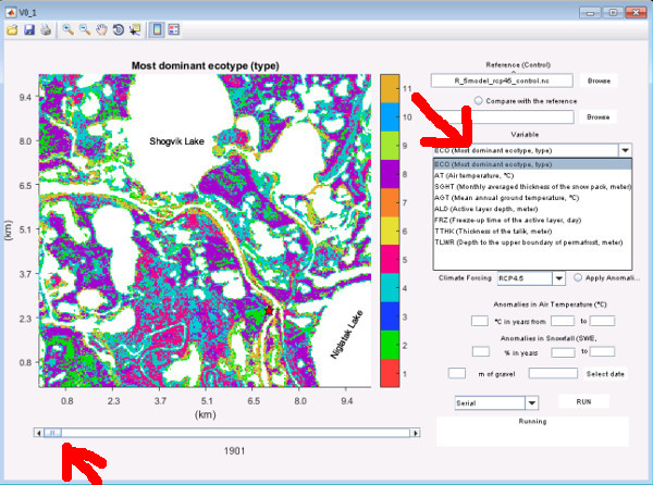
Figure 2. User can select multiple variables (Top arrow) to display for visualization at a given year by moving the slider (Bottom arrow).

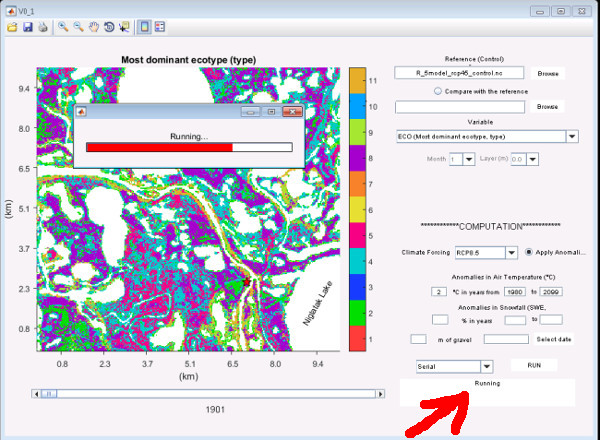
Figure 3. GIPL_GUI computation run. Status is given in the lower right box (arrow) and the pop-up window.

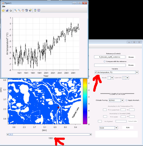
Figure 4. GIPL_GUI can display a time-series of a variable like air temperature (Top arrow) in addition to the spatial plot. The slider number refers to year (Bottom arrow), in this case the start year of the RCP 4.5 forcing temperature time-series.
List of outcomes that this task addresses.
1. Development of a decision-supporting software package to identify permafrost degradation on the local scale;
2. Permafrost thaw assessment in climate change impacted communities.
Selawik, Alaska
Use of the AIEM permafrost module output to assess the permafrost changes in the 21st century and their impact on existing and future infrastructure in the Alaskan Arctic.
GIPL R5 permafrost model. Forcing parameters from RCP 4.5 and 8.5 (IPCC). Dominate Ecotype parameters derived from Jorgenson et al. 2009. Near surface air temperature records from U.S. National Weather Service (NWS NOAA).
GIPL2 Selawik Model.
GIPL_GUI (Graphic User Interface)
Step 1: Download [Installer for MS Windows OS] and install (requires a reboot) the MATLAB Runtime [Windows] libraries that enable the execution of compiled MATLAB applications or components on computers that do not have MATLAB installed.
Step 2: Download and unpack the GIPL2 GUI model at any convenient locations on your computer.
Step 3: Find and execute GIPL2_Selawik.exe file. Opening of the application the first time might be slow.
Step 4: (Optional): Please send comments to Lei Cai (lcai4@alaska.edu) or Dmitry Nicolsky (djnicolsky@alaska.edu).


