Field Measurements
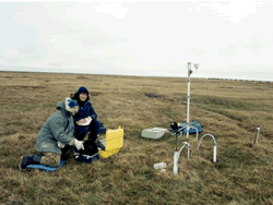
 The active layer and permafrost are the primary subsurface components of the Arctic land-atmosphere system. A permafrost research program is proposed that combines field measurements, laboratory measurements, and analyses and interpretations of data to be obtained at long-term study sites along a transects. These sites are in undisturbed areas, span a wide range of permafrost, climatic, and environmental conditions, include drill holes in the permafrost (from 40 to 75 m in depth), and have a long time series of data.
This research will focus on investigating how the active layer and continuous permafrost, in a variety of climatic and environmental settings, has responded and continues to respond to climatic change.
Methods for regular and direct observations of permafrost active layer parameters
Equipment
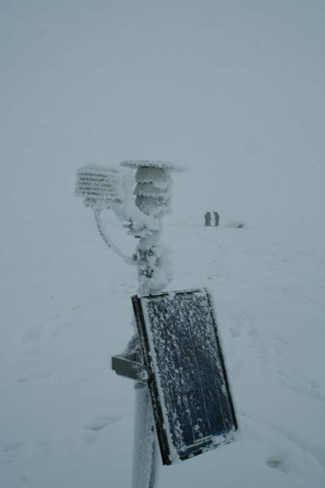
Temperature is measured by means of sensors “107 Temperature probe” (these sensors are made by company Campbell Scientific Inc, or by means the MRC-probe, made by company MEASUREMENT RESEARCH CORPORATION, or by means of sensors StowAway (XTI or Optic), made by Onset Computer Corporation.
The 107-sensors have to connect up to logger by rule: purple wire – to AG, red wire – do voltage of measurement (L or H), colorless wire – to G and black wire – in series by three tags to E1 or E2.
The probes into MRC-rod manufactured after April 12th, 2001 have the color codes: red-power (+5 v), black-ground, blue-output (analog out), orange-input (clock pulse).
The moisture of ground is measured by means of sensors “Hydra Probe”. These sensors are made by company Stevens Vitel Inc. You can make the acquaintance of the equipment with the original Stevens Vitel description.
The data are collected by CR10x measurement and control module with AM416 Relay Multiplexer. You can make the acquaintance of the equipment with the original Campbell Scientific Inc. tutorial.
 Before the measurements in the field you have to calibrate all sensors “107 Temperature probe”. This operation means putting the sensors into a thermos bottle with ice dust and measurement of temperature. All sensors have to show a temperature of about 0°C; existing difference have to be taken into account during future measurements with these sensors.
Objects in the field
Any measurements are described with metadata.
Metadata (sample) (RTF-file, 9 kb)
Description of sites
For every site one must observe the thickness of snow-cover (along the profiles and over the logger), the thickness of active layer (at points of the regular 1m-grid), the weather (sun, clouds, wind, temperature of air). No long walks over the sensors! It is advisable to describe the landscape situation around the site (surface, shapes of snow-forms, activity of exogenous processes – especially cryogenic processes).
Operational procedure in the field (measurements and data storage)
Your need to collect measured data into computer by special program PC208E
No AC power-lines in the area of measurement!
Temperature
One ought to accumulate results of measurements in Excel-Spreadsheet with file-name in format: <NN>_d<YYYY>.xls; NN – this is the first letters of borehole site (for example, DH=Deadhorse), YYYY – this is the years of measurement (for example, 9700=1997-2000).
The measurements of temperature have to be corrected following the results of calibration data getting-up the result - see the sample. The results are processed and formatted in agreement with Joss standards and can be accessed in Joss strorage.
Moisture
First step: You begin to processing the field data about moisture of ground in different depths by transportation of initial file *.dat – to Excel-spreadsheet. Every Vitel (sensor) give 4 voltages (measurement). The field equipment checks every voltage against all sensors. For example, the voltage #1 check against the Vitel 1, after them – against Vitel 2, after them – against Vitel 3, and so forth) – see the spreadsheet.
However, We must to transform this order for win the result. We realize the data processing with the aid of computer special DOS-routine. This program gives back the result parameters – including the volumetric content of water, or the moisture of ground (“WATER”). The input-file for this program has to contain the number matrix in format “Text (tab delimited)” - with 6 columns (see columns from E to J in the below spreadsheet). The program asks we about A-probe. We must to answer “No” for the old sensors and “Yes” for the new sensors. After them we receive the output file for import him in result Excel – spreadsheet.


