IAPED - Investigation of Arctic Permafrost Degradation using ALOS data: A subproject to CIPEDIA
Project Summary

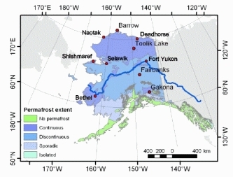
The characterization and quantification of permafrost degradation in different environments is of high interest in a global warming environment. An appropriate ALOS remote sensing dataset from a wide range of permafrost sites would be a major asset for this goal. Within IAPED, ALOS remote sensing data will be acquired for different environmental conditions along latitudinal transects in Alaska.
The data will be used for the generation of DEM and multi-sensor land cover classifications. Sites were selected on the basis of availability of existing environmental datasets from finished or ongoing studies (permafrost, geology, climatology, palaeo-environment).
The ALOS PRISM data will be used for the construction of high-resolution DEM of these sites equivalent to 1:25 000 map scale. These DEM allow e.g. the quantification of subsidence areas due to Holocene permafrost degradation, as well as the identification of hydrological components of thermokarst and thermo-erosion. In conjunction with multi-spectral and radar imagery from AVNIR-2 and PALSAR, the surface characteristics of the study areas will be determined applying land cover classifications based on multi-sensor image processing. Similar approaches have been successfully tested for DEM derived from digitized topographic maps and Landsat-7 imagery (Grosse et al., 2006). It is expected to derive much more detailed information from higher-resolution PRISM DEM and AVNIR-2 data, and the incorporation of PALSAR data. The resulting datasets from the various study areas will be analyzed along with local climatologic and geologic data, and compared between each other.
Additionally, for some sites, interferometric analyses with multi-temporal PALSAR data will be conducted. From this three-year study, information on surface changes related to permafrost degradation at these sites could be derived. Additional ground truth information will be collected from existing permanent climate stations (surface and subsurface) at these sites and by new D-GPS data.


