Process Studies: Permafrost Observation, Analysis, and Interpretation
Project Personel
Main Contact: William Cable
Scientific Personel: V. E. Romanovsky, K. Yoshikawa (Water and Environmental Research Center, UAF, Alaska), S. S. Marchenko, G. S. Tipenko, A.D. McGuire (Alaska Cooperative Fish and Wildlife Research Unit, UAF), Nicole Mölders, Igor Semiletov, Natalia Shakhova (IARC, UAF, Alaska)
Collaborators: J. Christensen (Danish Meteorological Institute), H.- W. Hubberten (Alfred Wegener Institute, Potsdam, Germany)
Partner Organizations: Stevens Inst. of Technology, New Jersey (N. Panikov), University of Kansas (P. Gogineni), International Permafrost Association (J. Brown)
Project Summary

This project is a logical continuation of our last project to record and archive the data on active layer and permafrost dynamics at our sites within Alaska. The data we collected from these sites during the previous field season. Quality control was also performed and data were converted in a standard format for the submission to JOSS and to NSIDC for archiving. We are contributing material to the IARC web site describing CAMP.
The work on transfer the knowledge gained in permafrost dynamics research into the development and implementation of an evaluated soil-freezing/thawing module in CCSM was continued. We worked together with N. Mölders group on comparison between modeling results from the CCSM and our site-specific models. Input data and results of site-specific comprehensive permafrost modeling from the "cold permafrost" site (Barrow) prepared and compared with the results of application of a coupled GCM. We prepared data for comparison at two additional sites ("warm permafrost" and "no permafrost") from the Seward Peninsula. We are also preparing necessary input data for spatially distributed permafrost model GIPL for the entire Alaska. First version of a new spatially distributed permafrost model for Alaska was developed and results were delivered at the Fall AGU meeting in San Francisco in two presentations, one of which was an invited presentation. We continued the work on interpretation of CH4 measurements in thermokarst lakes and lakes of other origin in the Fairbanks area and along the Alaskan transect (so far - south from Fairbanks).
We organized and conducted the Workshop on Spatially Distributed Modeling and Remote Sensing of Permafrost/Frozen Ground that was held in IARC, University of Alaska Fairbanks in October 17-20, 2004. Workshop was sponsored by International Arctic Research Center (IARC), University of Alaska Fairbanks, Office of Polar Programs, National Science Foundation USA, NASA, Climate and Cryosphere Program (CliC), World Meteorological Organization, and International Permafrost Association (IPA). 31 scientists from 11 countries (Canada - 3, China - 1, Denmark -2, France - 1, Germany - 2, Japan - 1, Kazkhstan - 1, Mongolia - 1, Norway - 1, Russia - 3, USA - 15) participated in this workshop. 30 presentations were made during the workshop.
|
|
| |||
|
|
| |||
|
|
|
Thermal state of permafrost in Alaska
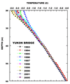
A comprehensive system of permafrost observatories was established in the late 1970s and early 1980s by the Geophysical Institute, University of Alaska Fairbanks along the Trans-Alaska Pipeline and at other locations in Alaska (Osterkamp, 1983; Osterkamp, 2003; Osterkamp and Romanovsky, 1999). Depths of these boreholes are typically 60 to 80 meters and measurements are usually taken annually. Many of these observatories are also equipped with shallow (down to 1 meter) cables for temperature measurements and soil moisture sensors.
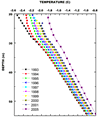
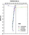
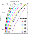
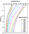
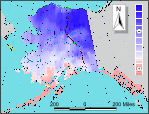
During the last 20 years, permafrost temperatures in Alaska have been changing noticeably. Generally, an increase in permafrost temperatures in Alaska during the last two decades was more pronounced at the coastal Arctic sites (from 1.5 to 3.0°C at the permafrost table) and less pronounced in the Interior Alaska (from 0.5 to 1.5°C).
Barrow Site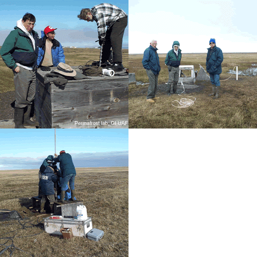 | HAARP Site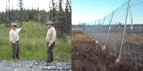 |
Click on the photos to get more information about these projects
GIPL 2.0 - Spatially Distributed Model of Permafrost Dynamics in Alaska

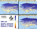
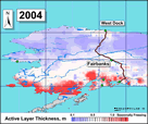
Given the possibility of climate warming in the near future, an evaluation of the magnitude of changes in the ground thermal regime becomes desirable for assessments of possible ecosystem responses and impacts on infrastructure in the Arctic and sub-Arctic regions. In the past, a soil model GIPL 1.0 developed at the Geophysical Institute Permafrost Lab was used to simulate the dynamics of the active layer thickness and mean annual ground temperature, both retrospectively and prognostically, using climate forcing from Global Climate Models. The GIPL 1.0 model is a quasi-transitional, spatially distributed, analytical model for the active layer thickness and mean annual ground temperature. This model is incorporated into GIS, which contains the information on geology, soils properties, vegetation, and snow distribution.
GIS allows visualization of input and output parameters and their representation in the form of digital maps. As a further significant step in the GIPL model development, we replaced the analytical solution with a numerical model based on a finite difference method for the non-linear Heat Conduction Equation.
In this model the process of soil freezing/thawing is occurring in accordance with the unfrozen water content curve, which is specific for each soil layer and for each geographical location. For each grid point on the map we used a one-dimensional multi-layer model of soil down to the depth of a constant geothermal heat flux (typically 500 to 1000 m). At the upper boundary, there are insulating layers of snow and vegetation that can change their properties with time. Special Enthalpy formulation of the energy conservation law makes it possible to use a coarse vertical resolution without loss of latent heat effects in phase transition zone even in case of fast temporally and spatially varying temperature fields. The new version of GIPL (GIPL 2.0) calculates soil temperature and liquid water content fields for the entire spatial domain with daily, monthly and yearly resolutions. The merge of the new GIPL and the GIS technique provides a unique opportunity to analyze spatial features of permafrost dynamics with high temporal resolution.
Together with N. Mölders group, we found fairly good agreement between our temperature measurements and modeling at the Barrow site with modeled soil temperatures when properly parameterized soil temperature module of a GCM was used. We continue to investigate the sources of the modeled results deviation from measured data.
Development of principal and other disciplines
This research should make important contributions to Arctic System Science as it offers a mechanism by which field-based and modeling research in both climatology and permafrost geophysics can be synthesized in the context of modeling the Arctic System. We believe that the study we are conducting will help articulate future research directions for representing the role of high latitude terrestrial ecosystems in the Arctic System.


